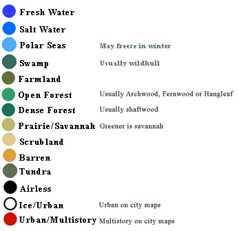
Except on the whole planet map, names in blue are links. The blue is not always the correct link shade to insure readability against the background. All other labels are black, white or gold
Note that on most basin maps the named cities take up so little land area that they may be difficult to locate. They are at one end or the other of the name.
These maps are based on aerial data, most of it taken from high altitude balloons before Centorin was discovered. It was last updated using data from the gateship Almon's Crossing in 3818.
The colors are not always identical from map to map. In some cases the species of plants are different, in some cases the photography is at fault. In many cases each pixel on the map has more than one type of ground cover and it's color is intermediate between several colors. This key gives one the general idea.
There is no direct elevation detail on these maps except that all significant areas over 13,781 ft. oxygen barometric altitude are black. That is a geographer's convention. Some individuals can explore much higher altitudes but there are few permanent settlements above those altitudes.
When using this key, you will find it convenient to resize the window to keep only the key info visible while going thru the maps.